Compared to other advanced ancient civilizations of the same era, such as Greek or Chinese, we know relatively little about the Etruscans who dominated central Italy for nearly half a millennium, from~800 to 300 BCE. Several factors contribute to this sorry state of affairs.
The Etruscan language is still a puzzle for modern linguists who can understand only a few hundred words. It has long been considered a language “isolate” and is not in the Indo-European family. Although early Roman authors refer to an extensive Etruscan literature, something that would help immensely in understanding the language, nothing readable remains. Various explanations have been advanced for this surprising absence: the intentional, systematic destruction of Etruscan literature by early Christians eager to stamp out “pagan superstition,” the fragility of the medium used to record writing, the natural extinction of a language not as widespread in the ancient world as, say, Greek. Probably all of these played a part.
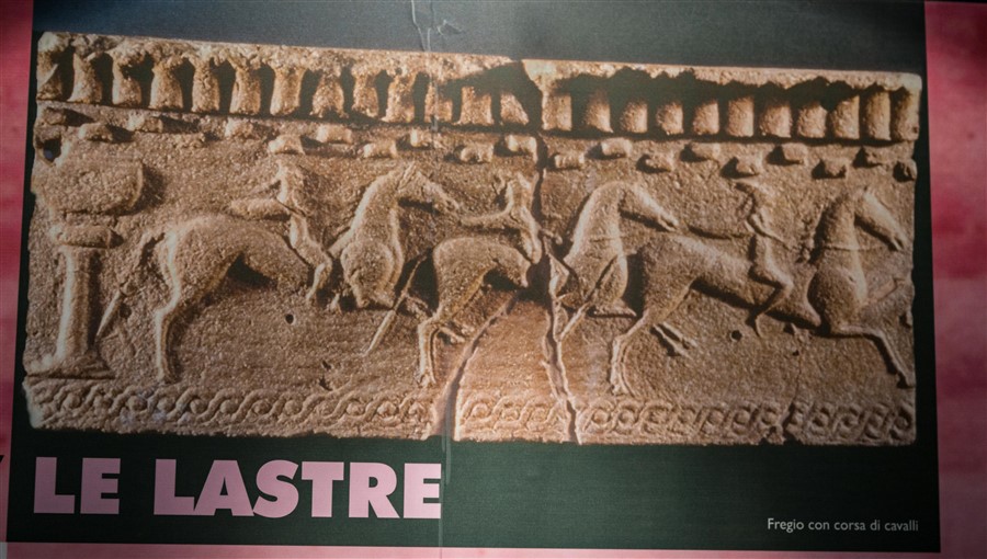
Decorative plaques depicting a bareback horse race reminiscent of today’s palio
Terra Cotta decoration covered the wooden beams that supported building roofs
The Etruscans loved horses and their images show up often in art and decorative motifs.
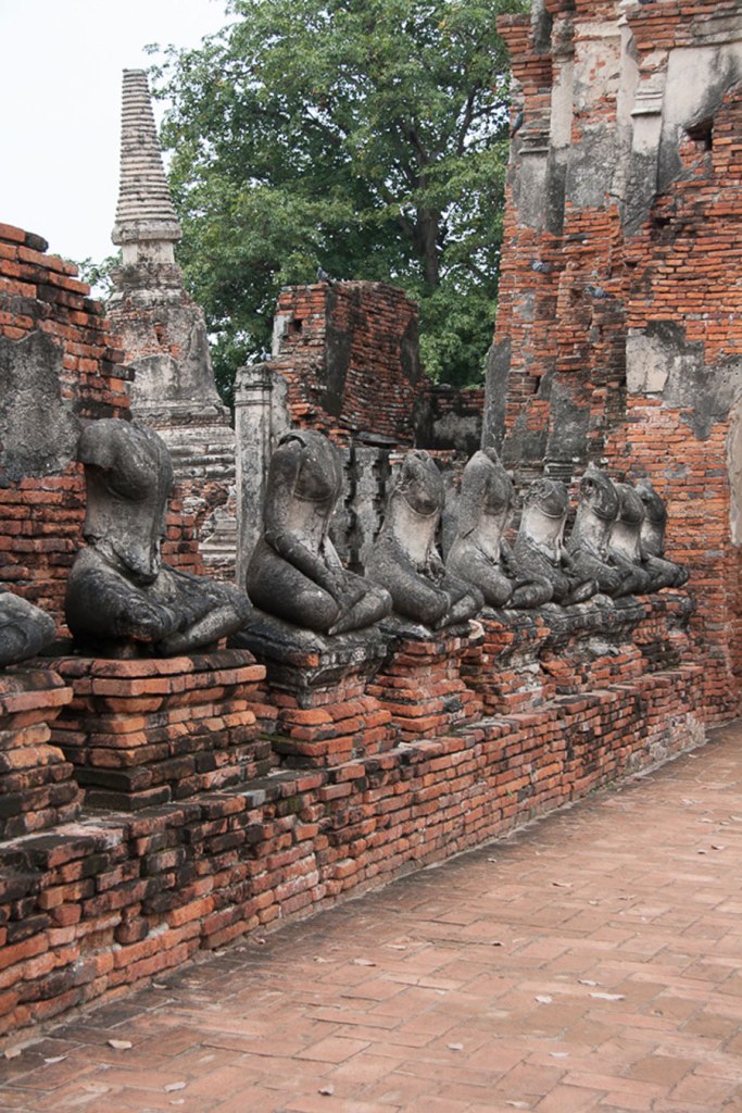
The Etruscans left no imposing temples or amphitheaters, no substantial remains from which we might reconstruct towns or buildings. Domestic structures were built of wood and plaster, materials that do not survive over centuries. Many Etruscan towns lie beneath those built over them in medieval and later times making excavation for archeological purposes impractical.
Finally, it seems clear that the Etruscan civilization was completely overshadowed – some say obliterated – by the conquering Romans who, nevertheless, took many of their ideas on art, road building, city planning, water management, law, religion, architecture, even clothing. Indeed the toga, the familiar outer garment of Roman citizens, was appropriated from the Etruscans. Contemporary bloggers and Tuscan travel sites have taken up the cause of this amazing civilization, hoping to set the record straight.
Despite these obstacles, we know enough about the Etruscans to merit the admiring descriptors I have used above. How? Most of what we know comes from contemporary Greek, Roman, Egyptian and Middle Eastern sources.They are not without their prejudices but give us enough information to create a sense of Etruscan society, its history, structure, and functioning.
In addition, while the Etruscans left no temples, above ground tombs, usually small stone buildings but sometimes very large round structures, have been found. These may be furnished and decorated with magnificent, vividly colored wall paintings which give us a glimpse into their daily lives and social attitudes.
Harvest festivals are common the world over and autumn in Tuscany sees many celebrations of Italy’s most popular foods: truffles, porcini mushrooms, chestnuts, pumpkins, olives and, of course, grapes. Some feste last for days and include vendors selling dishes that show off the newly harvested food. Others are evening affairs, often dinners where the food is cooked by locals and the proceeds support some local project or charity.
When we told Marzia and Renzo that we like going to food fairs and community celebrations they immediately swept us off to an evening harvest festival at the hamlet of Ponte a Tressa, about 30 minutes away. There, as we stood in line perusing the menu (which was in Italian, of course), a local was heard to say (also in Italian, of course), laughing, “Well, it’s looks like we’ve made it: the Americans are here!” This was reported by Allegra who with Renzo ordered for all of us, as the only thing we recognized on the menu was pizza. We sat at long tables and ate family style. The main ingredient was goose cooked several ways: goose stew, sliced goose, stuffed goose neck, With each dish came potatoes, also cooked in different ways. We had a variety of bruschetta as well as the ubiquitous pizza and, of course, vino. There was a live band and dancing, pens with farm animals, games of chance and a stand where Renzo treated us all to limoncello, an essential and delicious finishing touch to a meal.
photo by Joan Krall
photo by Joan Krall
The second festa, some weeks later, was different. For the Buonconvento event, we bought tickets to a sit down meal at a table the size of our party (4 in this case). There was a choice of two complete meals which were delivered to our table.The food was good but not unusual and I don’t remember what we ate. Live music and other activities happened around the historical center, including a well attended fashion show. Buonconvento is Marzia’s home town and her father, who was in his 80’s, joined us for dinner. Most memorable from this experience was our leave taking with Marzia’s father. Again I quote Joan’s journal: “When we parted for the night he held each of our hands and, as translated by Marzia, thanked us for coming and wished the best for us always. Even though I could not understand a word that he said to me, I could feel the warmth and sincerity of his words. Sometimes feelings transcend verbal communication.”
Abbeys: Active, Inactive and Ruined
In any part of Italy one cannot help but observe the ubiquitous ecclesiastical structures: parish churches, monasteries, abbeys, hermitages, basilicas, many, perhaps most, still active after hundreds of years. In Tuscany even the smallest hamlet has a church and the region abounds with Romanesque, Medieval and Gothic religious buildings.
So what is an abbey? An abbey (abbazia in Italian) is essentially a monastery that is autonomous and governed by an abbot. It often includes a number of buildings – church, living quarters, refectory, cloister, library, agricultural structures – as well as landholdings. The abbot is likely to have more involvement in the surrounding community than, say, a parish priest or a prior. Abbeys were built across Europe in the Middle Ages according to a plan written by he founder of the Benedictine religious community. Tuscany, particularly Siena province, is rich in abbeys. Because they were often built in relatively secluded places and because they were meant to reflect the simplicity of monastic life, their architectural beauty set in a spectacular environment is immensely attractive, even if one is not religious.
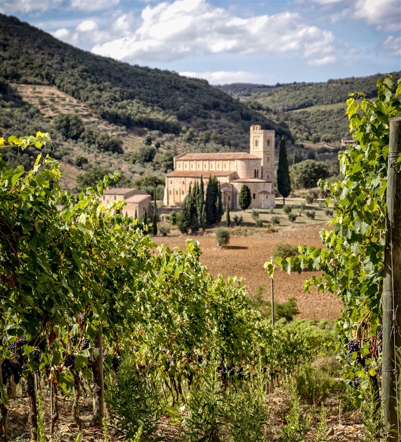
Abbazia di Sant’Antimo
We visited two of the most famous and beautiful active abbeys (Abbazia di Monte Oliveto Maggiore and Abbazia di Sant’Antimo), the breathtaking ruin of Abbazia di San Galgano and the remarkable cloister at Torri, now privately owned and open to the public only a few hours a week.
A bit of history and more images of these remarkable places are here.
Except for a day trip by bus from Siena to Florence, we drove our rented Fiat Panda from Pisa to Siena and all around the Tuscan countryside. I cannot describe the experience better than my spouse did in the journal she kept for the trip.
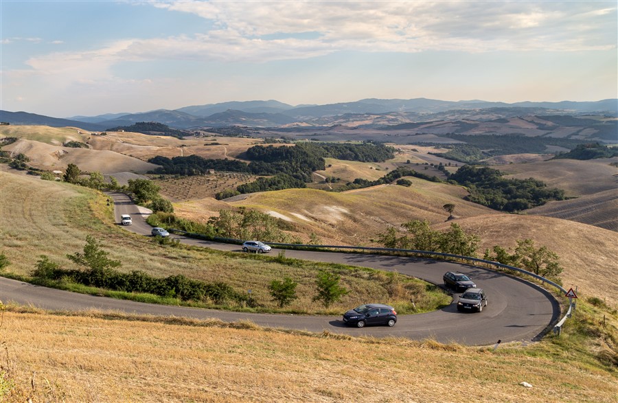
“The roads are narrow,hilly and curvy.”
“We have a Fiat Panda, small but not tiny. It is a stick shift which neither of us have driven for years. Steph* did all of the driving the two weeks she was here and we either all went in their car or we followed in ours. No easy task as Steph is used to driving stick shift and could race for NASCAR. The roads are narrow, hilly and curvy. Actually, they are a series of S curves interrupted by a U curve on occasion. I have heard of the 7 hills of Rome but nobody told me about the 700 hills of Tuscany. I think we have been up and down all of them at least once.
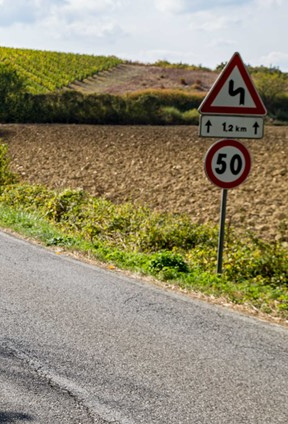
The ubiquitous road sign
Italians are very good drivers and you know one is behind you if you look up and see a car so close that you think you are towing it. Passing distances are short because of the curves and they get as close as possible before passing. Solid lines don’t matter. If they see a straight stretch of road they pass. There are also pedestrians walking on the road because there aren’t many sidewalks or they walk into a crosswalk even though you are coming at them at 30 mph. Then there are the cyclists riding on the narrow roadway.
But most distracting for me are the motor scooters. They drive right on the center line between cars and you don’t know where they in roundabouts since they move freely from right to left and visa versa.
We have had a few scares like when a truck is on our side of the road on a curve or someone is passing when they shouldn’t be. I have stalled out in the middle of an intersection and rolled backward when I wanted to be going forward. We both find ourselves in the wrong gear at times and I often forget to take the emergency break off, but all in all we are doing OK.”
*Our party consisted of my niece Allegra (who is fluent in Italian, often mistaken for a native) and her spouse Stephanie, my sister Lucretia, me and my spouse whose name is also Joan (aka JK). Marzia (who is fluent in five languages, including English) and Renzo are Allegra’s friends and our gracious landlords/hosts. Allegra, Steph and Lu stayed for the the first two weeks; we were on our own after that.
Getting Around to…
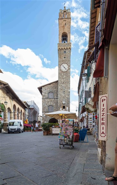
Hilltop Towns
Strolling through Pienza
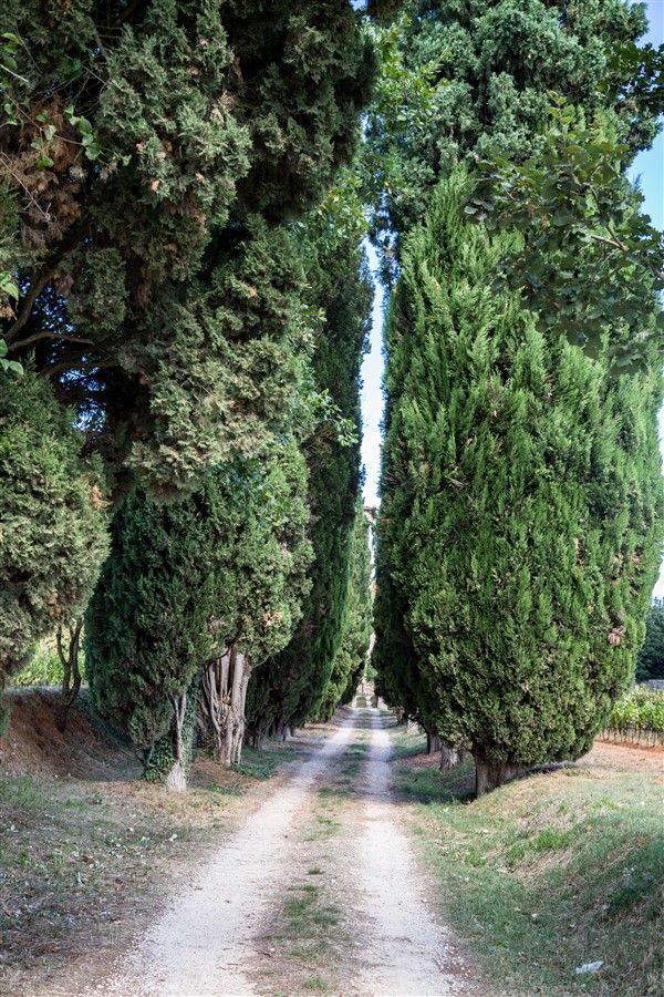
The hilltops around Siena are dotted with Medieval towns and hamlets, at least 200 of them having their ancient walls, fortresses and tower houses more or less intact. Cars are left in parking areas outside the walls and access to the center is on foot. Steep narrow lanes wind up and down the hilltops, the sturdy stone houses abutting them connected together, often fronted with flower boxes and plants.
Montalcino, best known for its Brunello, a very expensive red wine
Most towns have at least one Romanesque and/or Renaissance era church, often with stunning frescoes by master artists, and a main piazza with a town hall sporting a Gothic facade and a tall central torre. Inevitably – thankfully – restaurants and coffee bars ring the piazza.
Some towns can date their origins to Tuscany’s ancient (900-400 BC) people from whom their name derives, the Etruscans, and feature archeological ruins and artifacts in their Etruscan museums. Others have become famous for their wines and still others are, as Marzia called them, “unspoiled,” not frequented by tourists and so absent the crowds and the shops that cater to them.
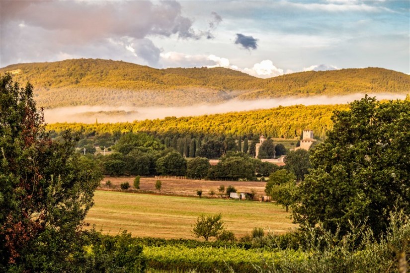
We visited some of each. With Marzia’s help we identified Etruscan towns (which interested me), wine towns (which interested Joan), “unspoiled” towns, towns of particular beauty or historical importance, hot springs, ruins, active abbeys all the while enjoying iconic Tuscan scenery, from the Crete Senesi to the Maremmacoast. Images from these excursions are here: Hilltop Towns, Hilltop Towns II, with more to come.
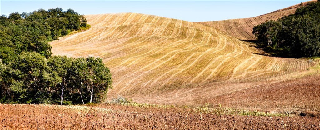
In the Crete Senese after the harvest
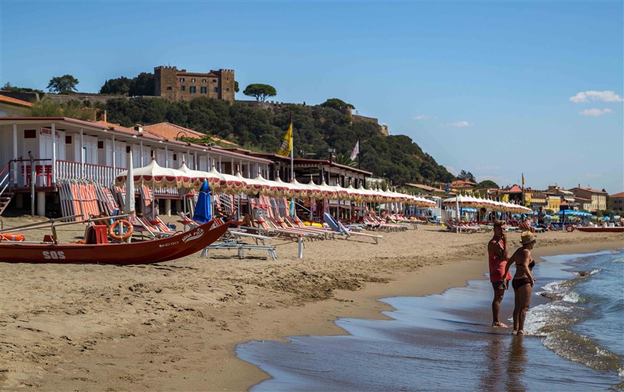
By the Tyrrhenian Sea at Castiglioni della Pescaia
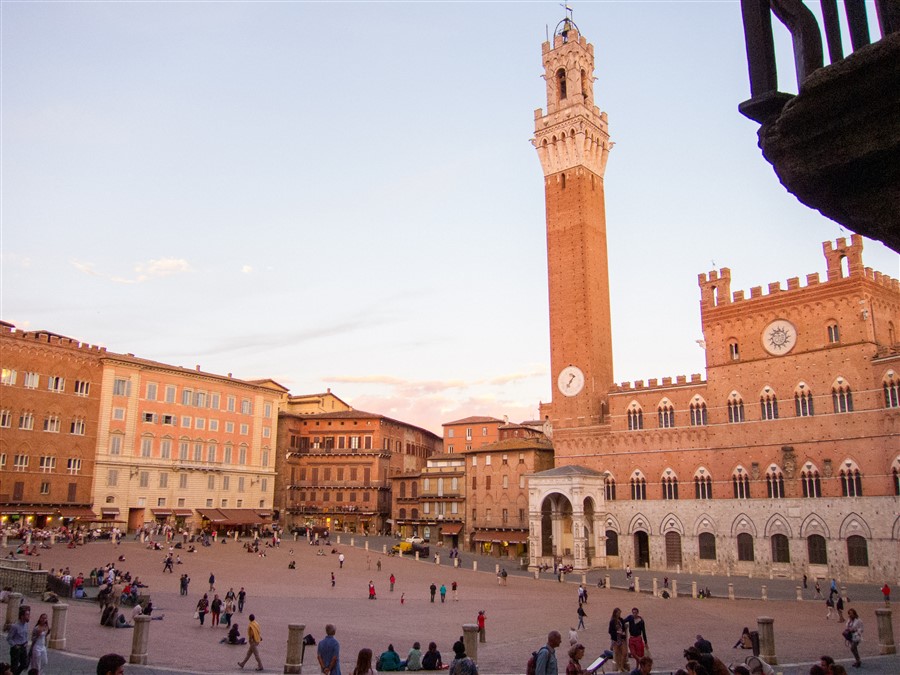
il Campo with the Torre del Mangia and the Pallazo Pubblico
The Historic Center of Siena is a UNESCO World Heritage Site described as “the embodiment of a medieval city.” At its center is the public square, Piazza del Campo, widely regarded as one of the finest in Europe owing to its beauty and architectural integrity. It’s shaped like a scallop shell with the flat portion bordered with the Pallazo Pubblico, the historic seat of local government, and, rising from it, the magnificent Torre del Mangia,. The latter was built to match the height of the Duomo di Siena to signify that the church and the state were equal, having the same level of authority.
Siena was created when three communities that existed on three adjacent hills coalesced. At the intersection of the Y that delineated the roads to those communities and beyond, there was a valley that served as a convenient marketplace. This is the site of il Campo, as it is commonly called, meant to be a neutral territory for activities, games and political and civic holiday celebrations. Its present form was created in the mid-14th century with deliberate intention to establish harmony between the buildings and the square. The palatial homes of Siena’s ruling elite lining the square were required to have uniform roof lines in contrast to the earlier tower houses, symbols of community strife.
The Piazza was intended as an area where the entire population of the city could attend activities. The population of Siena in its golden era has been reported as between 50,000 and 80,000. Today, for the Palio, 28,000 people cram into the center and another 33,000 line the perimeter.
The red brick herringbone paving of the Piazza slopes slightly downward, inviting one to simply sit down as if at a beach or amphitheater, and that is exactly what people do. It is possible to climb the 400 steps up the Torre del Mangia but I did not attempt that even knowing spectacular views of the city and the countryside were in the offing. Below is an image, not mine, taken from the top of the tower, to give you a feel for the magnitude of this splendid town center.
Il Campo, viewed from the top of the Torre del Mangia (Mark Sehnert, Public domain, via Wikimedia Commons)
Duomo di Siena
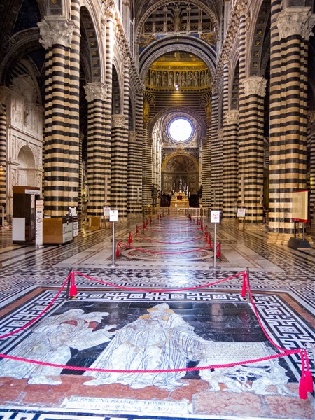
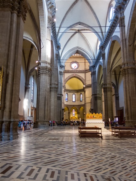
If you have been to Florence you will have been impressed by the immense cathedral, Santa Maria del Fiore, with its polychrome marble exterior and extraordinary dome. Siena’s cathedral, dedicated to Santa Maria Assunta, is not as large but boasts a most fascinating facade and an eye popping interior.
Compare the interiors of the two cathedrals, Siena’s on the left, Florence’s on the right.
Interior, Siena Cathedral
Interior, Florence Cathedral
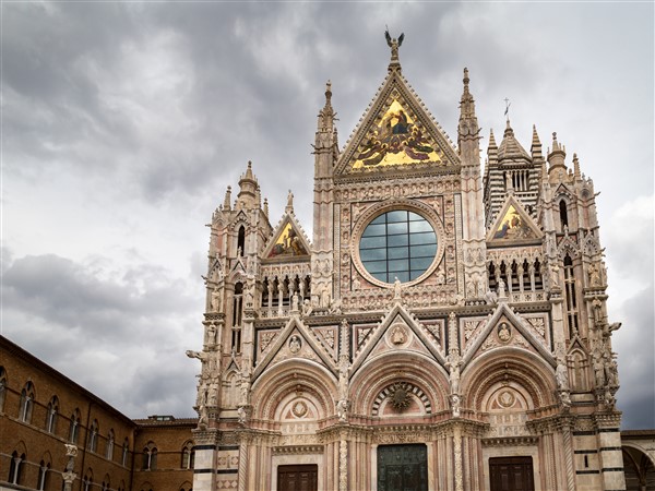
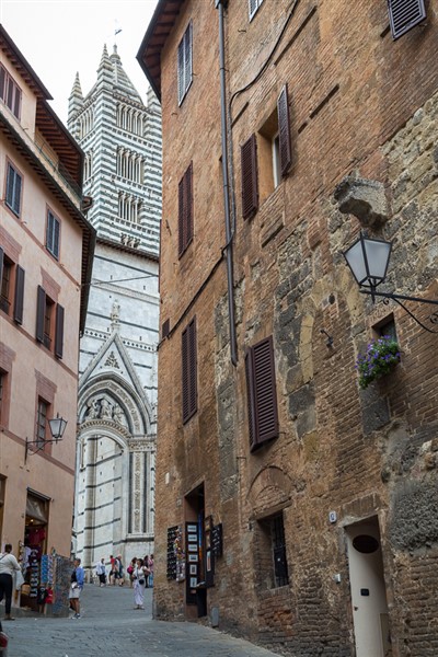
West Facade, Siena Cathedral
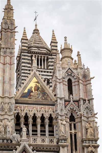
Upper facade with bell tower rising behind
The magnificent Duomo di Siena rises from a piazza atop one of the three hills above il Campo. Legend has it that it was built on the site of a 9th century Christian church which in turn had been built over a Roman temple dedicated to the goddess Minerva. Construction started in 1200; records show masses being held as early as 1215 and the main sections completed by 1264. Much of the exterior and the entire interior are sheathed with alternating layers of white and greenish-black marble. Black and white are the colors of the Siena coat of arms, arising from a foundation story that links the city to a noble and ancient ancestry.
Built in two stages, the lavish facade is a combination of French Gothic, Tuscan Romanesque and Classical architecture. The lower facade, (1284-1296) with its three portals is covered with sculptures of prophets, sibyls, mythical animals and gargoyles, the work of Giovanni Pisano. The upper facade, which was finally completed some 60 years after Pisano left Siena for Pisa, features heavy Gothic decoration.
The interior is a dazzling collection of sculpture, painting, stained glass, inlaid wood and mosaics. One hardly knows where to look first. I visited the Duomo on two occasions but could have spent the entire month exploring its treasures. For me the most impressive and beautiful of these treasures are the mosaics that completely cover the floor, 56 interlocking slabs covering 14,000 square feet, depicting scenes from Classical antiquity, the Old Testament, allegories, all of which meant to send a message of salvation and wisdom to the viewer. It is now possible to climb above the vaults for extraordinary views of the interior and exterior. Once again I rely on an other’s stamina to provide you with a glimpse of the extent of the unique marble mosaic floor.
Beautiful mosaics cover the entire floor of the Duomo’s interior (image from the “Gate of Heaven” itinerary)
Find more images of Siena and it storied art and architecture by looking here.
Most people, when they think Tuscany, think Florence and maybe San Gimignano with its 14 intact ancient towers. Siena, if considered at all, is an afterthought, maybe worth a day. What they are missing! As Rick Steves has so eloquently pointed out, Siena’s eventual political and economic irrelevance has preserved its Medieval identity, to our gain. It wasn’t always so, the irrelevance, i.e.
From the early 12th C. to the mid 16th C. the Republic of Siena, consisting of the city and its surrounding territory, was one of the powerful warring city states of the Northern Italian peninsula, in a class with Milan, Venice, Florence, Genoa. It rivaled Florence in the arts and financial prowess during the 13th and 14th centuries. Devastated, like much of Europe, by famine and the Black Death, it was finally defeated by the Republic of Florence and remained under its rule, a backwater, until Italian unification in the mid19th C.
Even today the Senese* will tell you they feel treated like 2nd class citizens when it comes to political pork, but they are a proud and resilient people, valuing real pork more, living the good life. One aspect of that good life is the relative lack of vehicles within the walls of the city. Neither cars nor bicycles, with a few authorized exceptions, are allowed within the city walls, the restriction being policed by 24 hour cameras with heavy fines for transgressors.
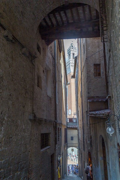
Typically narrow streets lead down into Piazza del Campo, left, and up into Piazza del Duomo,right
Having locals for friends and guides meant we knew which porto to enter for a given destination, where to find parking (sometime free parking!) and how to use the parking meters, any one of which might have defeated us otherwise. Once the car was sequestered we roamed within the walls, up and down steep, narrow streets flanked by tall Medieval buildings bedecked with flags of the contrade. Small or large open spaces appeared associated with important edifices like Gothic palaces or ancient churches and, of course, the Duomo and the Piazza del Campo. A bit about each of these unique Senese phenomena follows in subsequent posts and their accompanying pages.
*I have retained the Italian spelling for some key words and render them in italics.
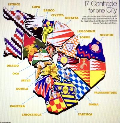
The Contrade of Siena
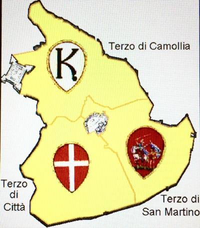
Siena is divided into thirds (terzi)
Siena is divided into three main parts each of which are further divided into contrade. Contrada in Italian means district or ward but these are much more than simply neighborhoods. They are a way of life: different populations in different states, held together by their histories and civic pride. In the Middle Ages Siena was said to have been divided into 59 contrade whose main purposes were to supply soldiers for mercenary armies and provide a mechanism to collect taxes.
Within each terzo are the contrade here identified by their flags
Over time the number and functions of the contrade have changed. There are now, and have been for about 300 years, 17 contradedi Siena, each having their own coat of arms, delimited territories, statutes, population, patron saint, museums, festivals, official representatives, church, baptismal fountain, motto, songs, allied contrada and adversary contrada. Every important event – baptisms, marriages, deaths, church holidays, wine festivals – are celebrated only within one’s own contrada. Loyalties are fierce and competition even fiercer, especially for the twice yearly run bareback horse race called the Palio.
More about the contrade and, in particular Bruco, which we visited, here.
My grandparents on both sides came to the US from Italy in the early 20th century. They came from the length of Italy: the Piedmont in the north, Calabria in the south and Abruzzo in the middle. I visited the country on several occasions many years ago, meeting a few distant relatives with whom I could only smile and nod, not speaking Italian and they not speaking English. Most of the time there was spent in typical tourist pursuits: visiting museums and Roman ruins, driving to well known towns, eating delicious food, shopping for specialty items.
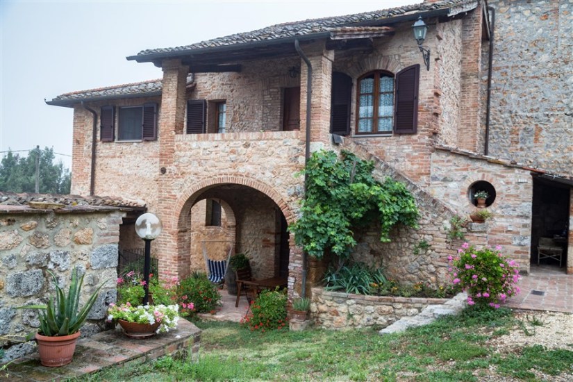
The best ever trip to Italy occurred in 2013 when we spent a month in the Tuscan countryside a little south of Siena. Here’s how it came about. My niece, Allegra, – so this is third generation – is a scholar of Italian literature, speaks the language fluently, has lived and studied in Siena. She has many good friends there one of whom rents their renovated big old family farmstead to visitors. She gave us a special rate for the month of September and five of us set out for the countryside near Sovicelle, about 12 miles southeast of Siena.
Landing in Pisa after 20 hours air travel, we still had a grueling 2 hour drive to our destination, missed the turn to the hamlet of Caldana but continued on down the road to Rosia to shop for dinner. On arriving at the old homestead, now aptly named Casabella, we found mounds of fresh ripe tomatoes on the counter, a refrigerator full of goodies like panna cotta and plum tart.
Marzia and Renzo, our landlords, were more like our hosts and we their valued guests. Two days after we arrived they came by with an Australian friend in tow to prepare for the 8 of us a “light meal.” We had salami and prosciutto with cantaloupe, homemade tomato soup, Tuscan grilled meats (sausages, chicken, ribs), insalata, homemade pastries and good red wines, eaten at the traditional time of ~9:30 pm. You might think their friendship with Allegra explains this but reading the often long and detailed entries into theCasabellaguest log reveals they treat all their guests with the same generous attention and gifts of their time, culinary delights and information: hospitality unparalleled in my experience.
From this splendid base we explored the surrounding Tuscan countryside for a month: Siena, coffee bars,”unspoiled” hill towns, wine country, harvest festivals, Etruscan museums, farmers’ markets, the seashore, ruined abbeys, singing monks, art installations, all the while partaking exquisitely satisfying food, addictive espresso and unsurpassed gellato.
When the tour company with whom we went to China expanded and began offering trips to Southeast Asia, I took notice. I had always wanted to see Angkor Wat, the temple-mountain built in the capital of the Khmer empire in the 12th century. Unfortunately, it was not part of the itineraries until a few years ago when a trip to Thailand was introduced. Three days at the end of that trip were devoted to Angkor province in Cambodia. The introductory price was amazingly low and even though I had sworn off 12 hour plane rides (LA to Beijing) I could not resist.
The trip did not start off well. Dealing with lost luggage on arrival meant missing our tour ride to the hotel and we found ourselves having to figure out how to do taxis in Bangkok at 2 am. After precious few hours of sleep the morning tour of Bangkok’s
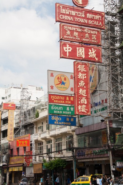
Bangkok’s Chinatown
Chinese Market felt like a forced march and my ankles looked like baseballs. However, a free afternoon and a good night’s sleep and we were ready for anything. And a good thing that was because the pace, as well as the heat and humidity, were intense.
I say more about Thailand in other posts and show photos on other gallery pages. We did spend most of our time there but my destination was Angkor.
Siem Reap is the small Cambodian town from which one visits the main temple complex, which is huge, covering an area stretching more than 15 miles east to west and 6 miles north to south. “Angkor” means “Capitol City” in Khmer, the official language of Cambodia. At its peak it was the largest pre-industrialized city in the world with a complex water management system that supported rice cultivation and close to 1 million people. There are about 1000 ruins of temples (few remains of secular works have survived) in the jungles of the Siem Reap area, many of which have been restored. We spent two days exploring several of the major temples and could have spent two months. Were I young and fit and had the means, I would plan to live in Siem Reap for a few months and explore the area via bicycle as an acquaintance has done.
More images of the Angkor ruins here and some impressions here.
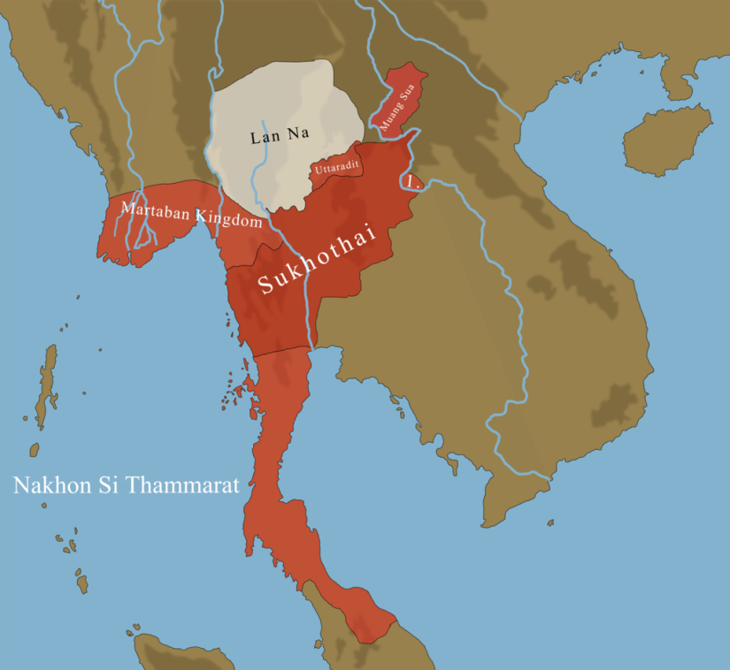
A long bus ride (the one where we heard in detail the history of the Rama Kings!) took us 250 miles south of Chiang Rai to the Sukhothai Historical Park, a 45 square mile UNESCO World Heritage Site encompassing the ruins of a monumental ancient Buddhist city that rivals Angkor in Cambodia. A small Khmer military outpost built in the late 12th or early 13th century Sukhothai was, originally, similar in design to Angkor, with Hindu temples and intricate canals.
Over a period of about three hundred years, 11th-13th centuries, people from the region which is now south central China gradually migrated into the northern and central regions of what is now present day Thailand. These were the Tai people, called “Siam” by outsiders. They intermarried with the local inhabitants and established tiny city-states subordinate to Khmer rule in the areas in and around Sukhothai. As the Khmer Empire declined owing to years of warfare with their neighbors to the east, the Tai moved quickly to assert their autonomy and then their independence from their Khmer overlords.
In 1238 a feudal lord, later known as King Si Inthrathit, united several city states into a single kingdom at Sukhothai and successfully defended it against the Khmer. A son of his, King Ram Khamhaeng, consolidated the kingdom, expanded its boundaries to the south and east, established Theravada Buddhism as the official religion and initiated trade with China.
For nearly 200 years Sukhothai flourished, partly because of its central location between the Khmer Empire to the southeast and the Burmese Kingdom of Pagan to the northwest. Although its diverse economy was based on agriculture, it became famous for the production of high quality glazed ceramics and exported them throughout Southeast Asia. It was also a center for the arts.
Under royal patronage Buddhism thrived. By the end of the 14th century Sukhothai was one of the largest Buddhist centers of the world. Buddhist monks were recruited from distant lands to live in the city with its exquisite monumental structures. Architects, engineers, skilled artisans came to build and decorate its temples and monasteries. The paintings, carvings and architecture associated with these temples and monasteries have a unique grace and eloquence, a style so distinct from Khmer and other regional styles that it is given its own name by art historians: “Sukhothai style.”
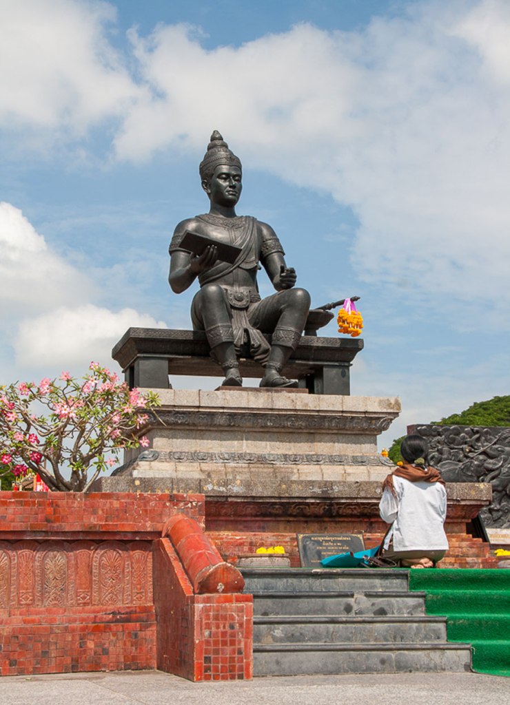
Kind Ram Khamhaeng, creator of the Thai alphabet
King Ram Khamhaeng is considered to be the author of the Thai alphabet. Hundreds of stone inscriptions found at the site give detailed accounts of the economy, religion, social organization and governance of the Kingdom of Sukhothai. It’s political and administrative systems are considered uniquely egalitarian for the time.
The prosperity and social harmony enjoyed by the inhabitants of Sukhothai derived in large measure from its amazing and innovative accomplishments of hydraulic engineering. Sophisticated dams, reservoirs, ponds and canals were created; water was controlled during times of drought or flooding. This management of water on a large scale served a variety of agricultural, economic and ritual functions. In this respect, Sukhothai is very akin to Angkor.
So much of what is considered uniquely Thai in art and architecture, language and writing, religion and law, was invented and developed in the Kingdom of Sukhothai that modern day Thais revere it as the birthplace of the Thai state. Sukhothai was its first capital city and King Ram Khamhaeng the Founding Father of the Thai Nation. In Sanscript, Sukhothai means “the dawn of happiness.” School children still memorize lines from a stone inscription dated 1283:
This land of Sukhothai is thriving. There are fish in the water and rice in the fields. The lord of the realm does not levy toll on his subjects. They are free to lead their cattle or ride their horses and to engage in trade; whoever wants to trade in elephants, does so; whoever wants to trade in horses, does so; whoever wants to trade in gold and silver , does so.
After the death of King Ram Rhamhaeng, its vassal kingdoms began to break away from the Sukhothai mandala and a new rival Thai state to the south, Ayutthaya, began to challenge its political supremacy. Although by 1378 Sukhothai acknowledged itself a vassal state to this new power it continued to be ruled by local aristocrats and the two states merged only gradually over the next 150 years. Sukhothai’s rigorous military tradition, centralized administration, architecture, religious practice and language significantly influenced those of Ayutthaya.
The patchwork of city states that was the early Ayutthaya kingdom was centralized (1455) after its expansionist policies rendered it too large to be governed by the mandala system. By the mid 15th century it had acquired not only Sukhothai (and, in the process, sacked Angkor, thus ending its 600 years of existence) but a portion of the Malay Peninsula. Later it incorporated parts of Burma, Cambodia and the northern Thailand cities (Lan Na kingdom).
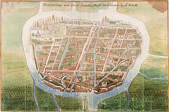
Painting of the city of Ayutthaya by a Dutch cartographer, ~1665
The city of Ayutthaya was situated at the head of the Gulf of Siam on an island surrounded by three rivers connecting the city to the sea, but far enough upstream to be protected from attack by the sea going warships of other nations. Halfway between India and China, it became an important center of trade and diplomacy at the regional and global levels. Europeans, initially the Portuguese but later Dutch, French, and English trading companies were given permission to trade in the kingdom. Enclaves of foreign traders and missionaries were established. Foreigners from many lands served in the civil and military administrations. The result was one of the world’s largest (probably a million inhabitants at its peak) and most cosmopolitan urban areas of its time.
As befits a wealthy, cosmopolitan connecting point between the East and the West, the arts – performance, literature, architecture – flourished in Ayutthaya. Theatrical performances of classical drama and dance (khon) originated in the Royal Court and were initially performed only there, but later spread and importantly influenced the development of the art in all of mainland Southeast Asia. Although in ruins, the large temples and monasteries are testimony to the technological skill of their builders. They were decorated with the highest quality of crafts, an eclectic mixture of regional art styles with those from India, Persia and Europe. This fusion of styles in art and architecture has characterized succeeding Thai eras.
At the ruins of Ayutthaya are row upon row of burned, headless Buddha statues. The Burmese believed that beheading Buddha images reduced the power of their enemies.
The Historic City of Ayutthaya is another UNESCO World heritage site. The ruins here are really ruins, all that remains after the Burmese sacked and burned the city for seven days and seven nights in 1767. Centuries long wars with Burma (now Myanmar) and nearly continuous dynastic struggles finally destroyed the Ayutthaya Kingdom. It’s art treasures, the libraries containing its literature and the archives of historical records were almost totally destroyed. What is known about the kingdom and its 34 rulers has been gleaned from old maps, such as the one shown above, and accounts of foreign visitors.
Chiang Rai is the northernmost major city in Thailand, the capital of Chiang Rai Province, a “golden triangle” area between Laos and Myanmar (formerly Burma). Once a hub of opium production, it is now a transit point for Rohingya refugees from Myanmar. The city, founded in the late 13th C., was part of the Lanna Kingdom for centuries. It was conquered by and remained under Burmese rule for 200 years before becoming a vassal state of Siam, then finally incorporated into Thailand in 1933.
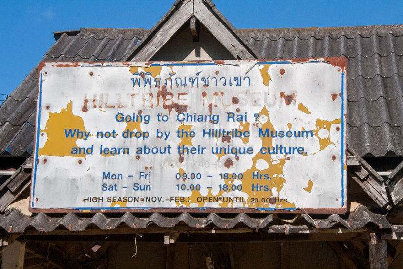
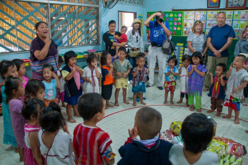
Several mountain ranges cross northern and western Thailand and extend across the borders with Laos and Myanmar; they are essentially the foothills of the Himalayas. In the higher elevations live a number of ethnic minority groups referred to as the “hill tribes.” They have traditionally been subsistence farmers of the “slash and burn” school, leaving when the land is depleted. These isolated communities are culturally and linguistically diverse. Following the pattern of hill people across the globe, these are poorer, disadvantaged groups compared with the dominate Thai who occupy the fertile valleys and they are often treated as outsiders, lacking rights in housing and legal status.
As part of World Spree’s “local connections program” we briefly visited a tiny hill tribe village outside of Chiang Rai spending most of the time at a preschool that was clearly in need of the support we indirectly provided. Cultural tourism has become an increasing source of income for the hill tribes. The village itself offered little in the way of attractions or shopping opportunity- the usual source of tourism revenue – but one enterprising woman donned traditional (Akha, I think) dress to pose for photographs and earn a few baht from the visitors. Click on an image to expand it.
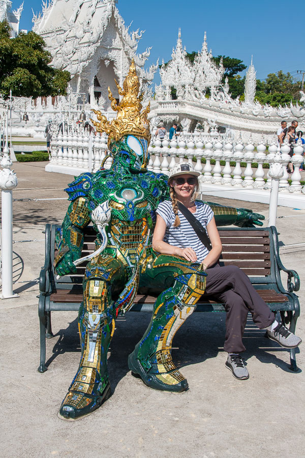
At the other end of the spectrum is Wat Rhon Khun which Wikipidea describes as ” a privately owned art exhibit in the style of a Buddhist temple.” Popularly known as The White Temple it is a fascinating collection of modern Thai Buddhist architecture and art, the life long project of a wealthy Chiang Rai artist, but it is not clear whether it is a monument to Buddha or to the artist.
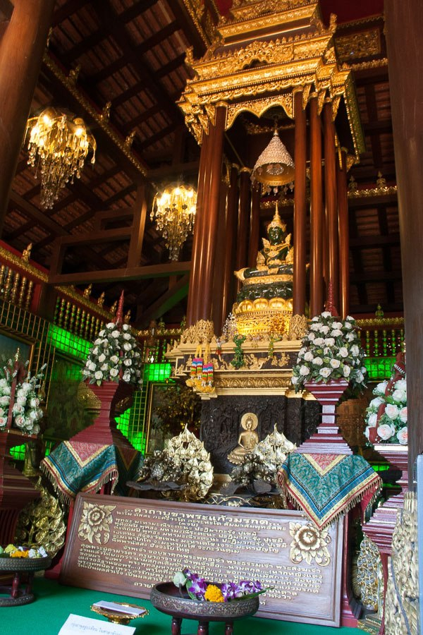
The Emerald Buddha
Thailand is about 95% Buddhist and there are many statues of the Buddha throughout the country: large and small, ancient and modern, simple and elaborate, private and public. Only one, however, is considered to be the sacred palladium of Thailand, a potent religious symbol that gives legitimacy to the king and protection to the nation. It is a relatively small (19” wide x 24″ high) statue of the meditating Buddha seated in the half lotus position, made of a semi-precious stone, perhaps jasper or jade.
This replica of the Emerald Buddha is in Chiang Rai where the original was discovered.
The older a Buddha image is the more power it is believed to have. The Chronicle of the Emerald Buddha is a text that traces the mythology and fabled travels of the image from the beginning of the common era, but its emergence as a historical reality is dated 1434. After lightening destroyed the chedi (stupa) of a temple in Chiang Rai a Buddha statue was found among the ruins. An ordinary looking Buddha covered in stucco, it was placed in the temple along with many other such statues. Some months later the head monk noticed that under the chipped stucco was a brilliant green color and ordered the stucco to be chipped away from the entire statue. It was seen to be made of one solid piece of green crystal without marks or imperfection. The Buddha quickly became an object of devote veneration and was coveted by kings, moved from one capital to another as their fortunes rose and fell, warring with each other and neighboring kingdoms. It was taken to Bangkok by the first king of the current Chakri Dynasty, Rama I, in 1784 who built a temple to house it on the site of the Grand Palace. It still resides there, in Wat Phra Kaew, where it continues to serve as a significant religious-political symbol legitimizing the power of the king, its caretaker.
I did not see the authentic Emerald Buddha but a replica residing in Wat Phra Kaew, Chiang Rai, where the original image was found. (The name of the temple was changed from Wat Pa Yah, meaning bamboo forest temple, when the Buddha was discovered.) The copy, which is very close but not an exact replica of the original, was carved from Canadian jade in China and installed in 1991 in honor of the 90th birthday of the Princess Mother. The name of the new image translates to Chiang Rai Jade Buddha.
More images from Chiang Rai and the White Temple here.
Chiang Mai, in northern Thailand, is the country’s second largest city. In the 14th century it was the capital city of a powerful Lanna Kingdom, an Indianized state, which ruled the area from the 13th to the 18th century and left a strong cultural heritage in language, food, art, architecture and music. Most memorable were our visits to a sacred temple situated on a hill overlooking the city and the Elephant Conservation Center in Lampang.
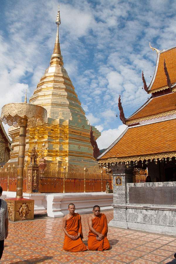
Wat Phra That Doi Suthep
This temple is considered one of the most sacred sites in Thailand where “pilgrim-tourists” come from Thailand, Singapore, China and India at a rate of about 120,000 per month. According to popular legend the temple was built ~1383 to hold a relic of the historic Buddha. A piece of the Buddha’s shoulder bone was placed on the back of a white elephant who was then released into the jungle. The elephant climbed Suthep mountain, trumpeted three times at the top and then dropped dead. This was interpreted as an omen and the first stupa was built. Over time many more holy shrines, pagodas, statues and bells were added and it is now a complex and extravagant site. Phra implies Buddha and That means a relic. Doi is the Northern Thai word for mountain, so the name of the temple tells what is there and where it is located.
Elephants have been ingrained in Thai culture for centuries: as weapons of war, symbols of wealth, power and moral authority, a key form of transport, and laborers in the teak logging industry. White elephants are considered sacred and may not work, be sold, given away or killed and are thus very expensive to maintain. Occasionally a Thai king would gift a white elephant to an enemy knowing that their expensive care would eventually bring financial ruin. This may be the origin of the idiom “white elephant” to designate something whose expense is out of proportion to its usefulness or value.
Elephants were used in war (left) and in the logging industry (right)
In 1900 there were an estimated 100,000 elephants in Thailand and the country had ~90% forest cover. In 1989, when logging was finally banned (the elephants were used to destroy their own habitat!) the forest cover was 28% and today there are only 3000-4000 elephants in the country half of which are living in captivity.
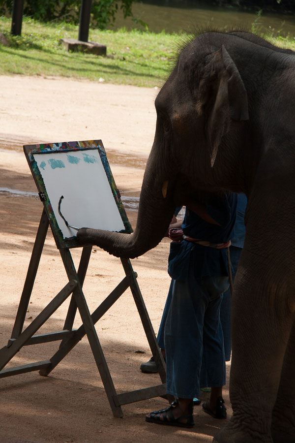
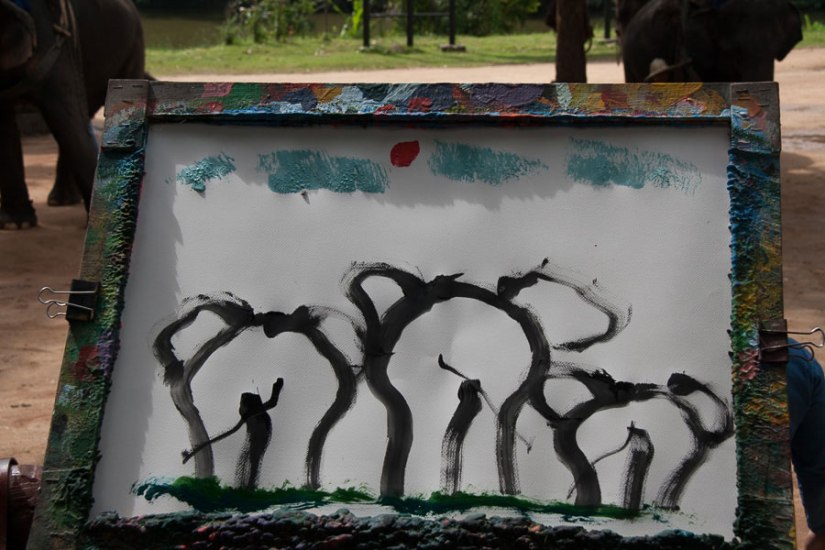
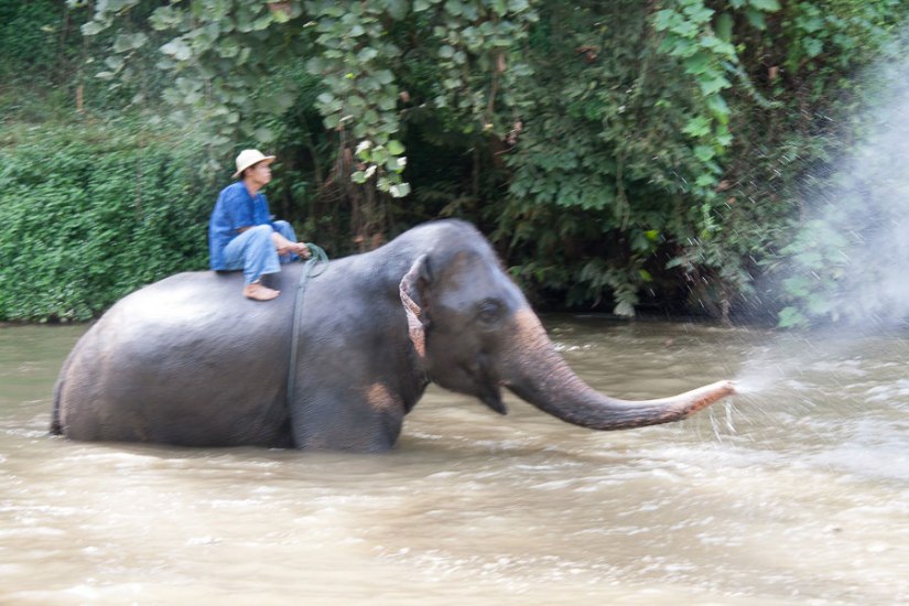
When logging was banned 70% of the domesticated elephants and their mahouts were out of work. Today tourism is the only viable source of income for them. Elephants require 300-500 pounds of food a day which, along with care and medical treatment, can cost their owners $500- $1000 a month. To make money mahouts offer elephant rides and elephant training classes to tourists. But carrying a human on its back is not natural for an elephant and for this to happen the baby elephant must go through a brutal process known as Phajaan (“crushing the spirit”) in which they are tortured until broken into submission.
There are a growing number of ethical sanctuaries in Thailand and other parts of the world. Unfortunately the one we visited was not among them. Although it was fascinating to watch the elephants bathing with their mahouts and trainees (tourists) and see them perform traditional logging tasks not to mention paint amazing images of flowers and other elephants, I felt sad at the realization that these magnificent creatures were reduced to vaudevillian acts to survive.


